
Airbus reinforces maritime security with launch of Ocean Finder

Pléiades Satellite Image – Warships In Norfolk, USA
October 26, 2018 – Airbus Defence and Space has launched Ocean Finder, a maritime tracking service, that helps locate vessels and other objects at sea.
The satellite-based service relies on a variety of data and optical sensors to deliver rapid detection and identification reports for small and medium sized vessels as well as large ships at sea. Ocean Finder supports a wide range of applications, such as monitoring fleets of ships, locating hijacked boats, illegal activities detection; maritime mission preparation as well as ensuring safety in hostile areas and supporting search and rescue operations.
According to Airbus, Ocean Finder leverages its satellite constellations, to offer a full spectrum of Earth-imaging data, spanning multiple resolutions and spectral wavelengths, along with in-house maritime expertise. The service combines freshly acquired imagery with additional information sources including AIS (Automatic Identification System) and open source data to deliver object-centric (ships, icebergs, oil slick) or area-centric (objects in a given area) detection and identification.
The service is accessed via a dedicated web portal allowing users to easily define the localisation and the surface of their area of interest and task the satellites directly. This can be activated in standard mode to support planned mission preparation, or emergency mode to support urgent intervention.
Related Posts
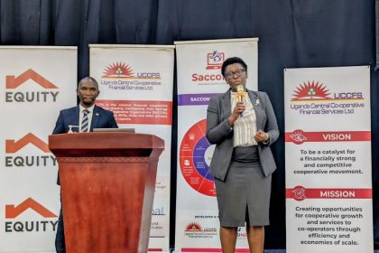 Equity Bank deepens SACCO and SME support with tailored financing push
 Equity Bank recognised for diaspora banking services at Pan-African awards
 African gaming industry faces tough choices as AI reshapes problem gambling prevention
 Global turmoil could reward patient investors, Stanbic analysts say
 Ethiopian Airlines, Boeing and ThinkYoung graduate 28 youth in STEM program
Get business news delivered to you everyday
Latest News

Stanbic Programme Targets 10,000 Women Entrepreneurs in Northern Uganda

Uganda to Premiere first Fully Fledged Tourism Reality TV Series after 15-year Journey

Uganda Embraces First National Cleaning Day as Civic Spirit Outweighs Fears of Resistance

IATA Launches Africa Safety Programme to Close Aviation Safety Gap

Walking the Talk: IATA Breaks the Glass Ceiling as Saadia Zahidi Becomes First Female Director General

Uganda, South Sudan Agree Roadmap to Stronger Trade and Border Security

Uganda’s Quality Chemicals Joins Merck’s Landmark HIV Drug Manufacturing Initiative

South Sudan Reacts to reports of selective visa-free entry policy

IMF staffers cite numerous gains for Africa in using AI to grow economies

Equity Bank Finances Safety-Focused Bus for Busoga High as Schools Tighten Learner Transport Standards